|
SEE ALSO:
Current Traffic Conditions at
Santa Monica
Freeway & 405.
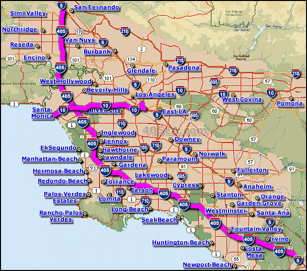
The Santa Monica Freeway is the most direct freeway route from
downtown Los Angeles to the LA coastline.
The Santa Monica Freeway is part of the interstate 10 highway
system... the most westerly section of the i-10.
The Santa Monica Freeway is rated as one of the most congested
Freeways in the world... and as a result, CalTrans has even
constructed special area's adjacent to the freeway to help alleviate
traffic congestion resulting from traffic incidents.
Traveling east from the coastline, the Santa Monica Freeway starts
approx. just a quarter mile back from the Santa Monica State Beach...
the Santa Monica Freeway then travels east towards downtown Los
Angeles. After reaching the Downtown LA area, the Santa Monica Freeway
shortly thereafter spurs off in 2 different directions; (1.) it
continues generally in a easterly direction where it becomes the
Ponoma Freeway, and (2.) it veers off in a northerly direction where
it simply becomes part of the i-10, which shortly thereafter is also
called the San Bernardino Freeway.
The Santa Monica Freeway is know by several names, including the
Rosa Parks Freeway, the Christopher Columbus Transcontinental Highway,
the i-10, and Interstate 10... the length of the Santa Monica Freeway
is approx. 17 miles long.
|